
A Guide To The Most Asked-About Hikes in Hostelworld Chats
Some hikes keep coming up in the Hostelworld chats. Not just once or twice: consistently, in the same cities, across months of conversations. The same questions repeated by travellers who just arrived and are figuring out their first few days.
“Which hostel is best for the Ha Giang loop?”
“Is the Salkantay trek worth it over the Inca Trail?”
“Does anyone want to do the Cocora Valley hike tomorrow?”
“What time should you start Pai Canyon to catch the sunset?“
These aren’t obscure questions. They’re the ones that define the trail for most backpackers who pass through a destination, asked by thousands of people who have all arrived with the same rough plan and want to know if it’s going to be as good as the photos suggest.
This guide covers the hikes and routes that generate the most chat activity across Hostelworld: the Ha Giang Loop, the Acatenango volcano, the Cocora Valley, the W Trek, the Salkantay, Pai Canyon and Sticky Waterfall, and a few others that keep coming up. Each one is real. Each one is worth it. Here’s what you actually need to know before you go.
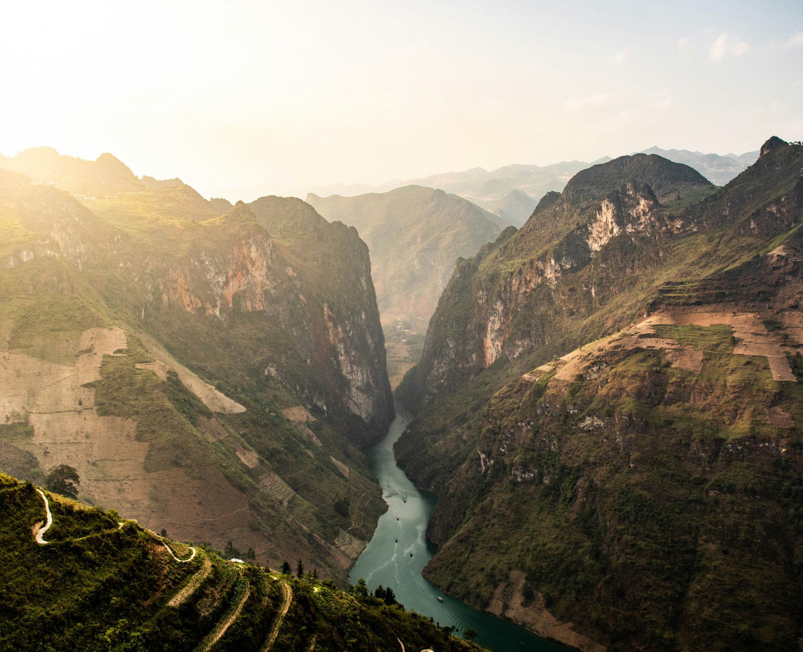
🌄 Ha Giang Loop, Vietnam: The One Everyone Talks About
No hike, route, or outdoor experience generates more consistent chat traffic on Hostelworld than the Ha Giang Loop. The questions are constant in every Hanoi, Hoi An, and Ha Giang chat: operator recommendations, gear advice, luggage storage, what to wear in winter.
From the Hanoi City Chat: “I’m trying to decide what’s the best loop tour to do? Which is more popular at the moment or what’s the best one?” And: “Which hostel is best for the Ha Giang loop?” And: “Hi, does anyone know where to find gloves for the Ha Giang loop?”
What it is: a 4-6 day motorcycle circuit through the mountains of far-northern Vietnam, passing through karst landscapes, rice terraces, ethnic minority villages, and viewpoints that rival anywhere in Southeast Asia. The roads are mountain roads, some are challenging, and the scenery is extraordinary.
Self-drive vs Easy Rider: you can rent a semi-automatic motorbike and ride independently, or hire a local “Easy Rider” guide who drives while you ride pillion. For inexperienced riders, the guide option is worth the extra cost. The roads demand respect.
Recommended operators mentioned in chats: Motorventures, Safari, Vision, Hong Hào, Infinity, Odyssey.
Best time: October to April for dry weather. Cold in January and February: bring thermals and a proper jacket. Gloves are essential and available cheaply in Hanoi before departure.
Luggage: store it at your hostel in Hanoi. Most hostels that cater to loop travellers offer free or cheap storage. From Hoi An: “For anyone that has done the loop, what did you do with your luggage? I have two and know I can’t bring them with.”
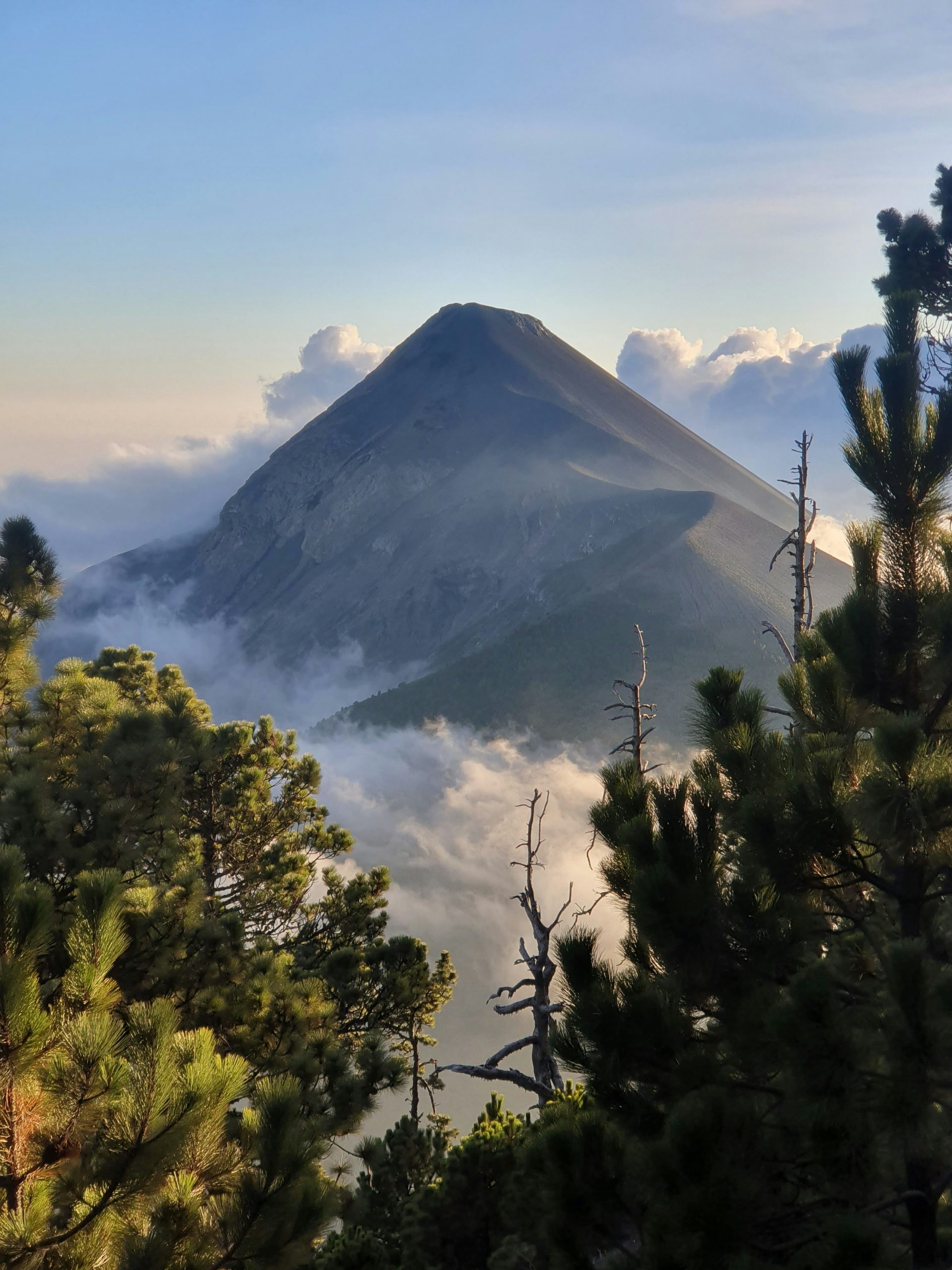
🌋 Acatenango Volcano, Guatemala: The Overnight Hike Everyone Is Asking About
Antigua generates constant chat activity around Acatenango, and the questions are consistent: guide recommendations, altitude sickness concerns, what to bring, whether the Fuego add-on is worth it.
From the Antigua City Chat: “heyy, did you guys enjoyed it? Any recommendations? I’m going next week. Also, did you pay extra to do the Fuego hiking?” And: “Does anyone have any altitude sickness pills leftover from the hike?” And: “Charles, what hike are you doing and is it a day one or overnight?”
What it is: a steep, demanding overnight hike to the summit of Acatenango (3,976m), camping at altitude with views of the active Volcán de Fuego erupting across the valley. On a clear night, watching Fuego throw lava into the dark is genuinely one of the most dramatic natural spectacles in Central America.
The Fuego hike: an optional add-on to hike the rim of the active volcano. More difficult, significantly more ash, extraordinary. Worth it if you’re fit and the conditions allow. Many operators include it as an option rather than a requirement.
Altitude: Antigua sits at 1,500m. The summit is nearly 4,000m. Acclimatise for at least a day in Antigua before attempting. Altitude sickness medication (Diamox) is worth discussing with a pharmacist beforehand. Headaches and breathlessness on the upper section are normal.
What to bring: multiple warm layers (temperature drops dramatically at night at altitude), waterproof jacket, hiking poles if available, headtorch, and snacks. Most tour operators provide tents, sleeping bags, and basic meals.
Cost: around Q350-500 (~€40-60) with a guide. Don’t do this one without a guide.
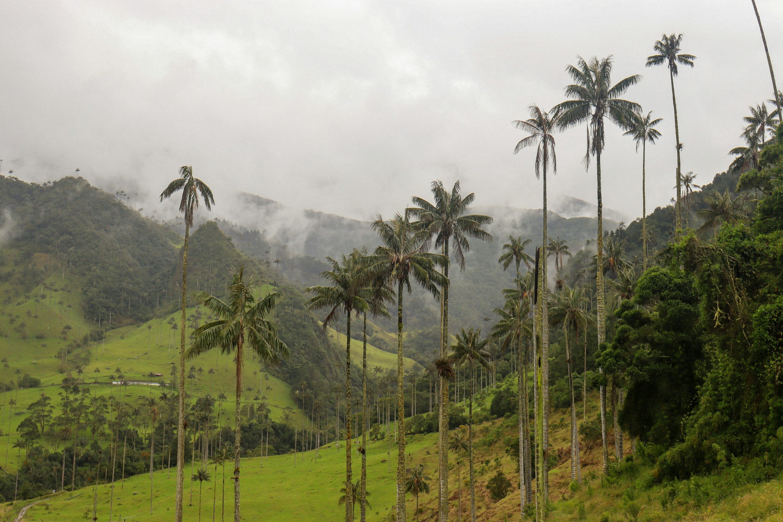
☁️ Cocora Valley, Colombia: The One With the Wax Palms
Salento is a small coffee-town in Colombia’s coffee region that generates a reliable stream of chat questions. The Cocora Valley hike is the reason most travellers are there.
From the Salento City Chat: “Just got to Salento last night and I’m down to do the tour tomorrow! I’ll be leaving from my hostel though.” And: “Do you know at what time the hike starts?” And: “We are arriving tomorrow in Salento. Any tips on what to do?”
What it is: a half-day to full-day hike through one of the most visually distinctive landscapes in South America. The Cocora Valley is home to the wax palm, Colombia’s national tree, which grows here to extraordinary heights, sometimes 60 metres, in a misty, green valley that looks like it belongs in a fantasy film.
The route: the classic loop from Salento takes 4-6 hours. Jeep to the valley entrance (20 minutes, cheap, departs from the main square), hike the circular trail through cloud forest and palm meadow, return to town. Some sections are muddy.
From Jericó City Chat: “If you go on any hikes here, prepare for everything to be very muddy.” This applies to Cocora too, particularly in rainy season. Waterproof boots make a significant difference. Gaiters optional but appreciated.
Best time: morning departures avoid afternoon clouds that can obscure the views. Jeeps run from around 6am. Go early. The valley is most atmospheric before the day-trippers from Medellín arrive.
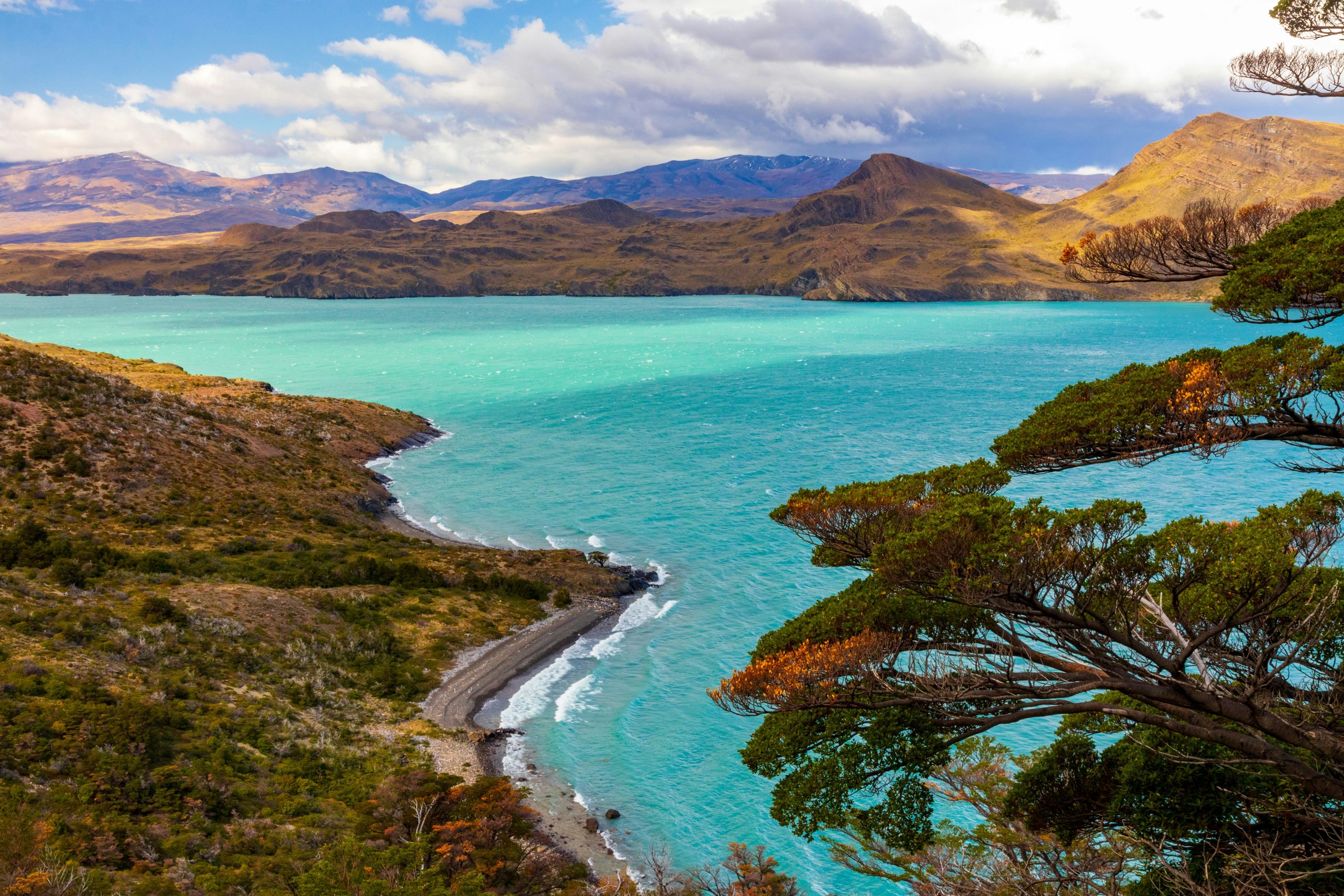
🏔️ W Trek, Patagonia: The Most-Planned Hike on the Planet
Puerto Natales is the gateway to Torres del Paine National Park, and the Hostelworld chats there are full of the logistics of the W Trek. The planning is more complex than most hikes and the questions reflect it.
From the Puerto Natales City Chat: “Hey just got here today, anyone else having a slow day in Puerto Natales? I don’t start the W trek until tomorrow, so looking to have a chill day today.” And: “Does anyone know if you need a sleeping bag when staying in the refugios along the W trek? Let me know!” And: “Anyone know where to get a gas canister?”
What it is: a 4-5 day (W route) or 8-10 day (O circuit) trek through Torres del Paine National Park in Chilean Patagonia. The W covers the three most iconic viewpoints: Mirador Las Torres (the famous granite towers), Valle del Francés, and Glaciar Grey. The scenery is extraordinary and consistently lives up to the photographs.
Book far in advance. Refugio and campsite spaces for the peak season (November to March) sell out months ahead. CONAF (the Chilean national park service) has a registration and booking system. Do not arrive in Puerto Natales without bookings.
Sleeping bag: yes, even in refugios that provide blankets. Temperatures drop significantly at night. A 0°C or -5°C rated sleeping bag is the standard recommendation. Rental is available in Puerto Natales.
Gas canisters: available in Puerto Natales at outdoor gear shops. Cannot be taken on flights.
Budget: the full W with refugio accommodation runs around $700-900 USD including park entrance. Camping is cheaper but weather-dependent.
🥾 Salkantay Trek, Peru: The Alternative Inca Trail
Cusco generates consistent chat activity around trekking, and the Salkantay specifically has become more popular than the Inca Trail for many travellers.
From the Cusco City Chat: “I’m not sure anymore if I’m gonna do it without a tour because it’s a bit more dangerous doing it in the rainy season and I’m not that experienced hiker either.” And: “Usually yes but check with them. You can WhatsApp them, it’s on their website: salkantaytrekking.com.”
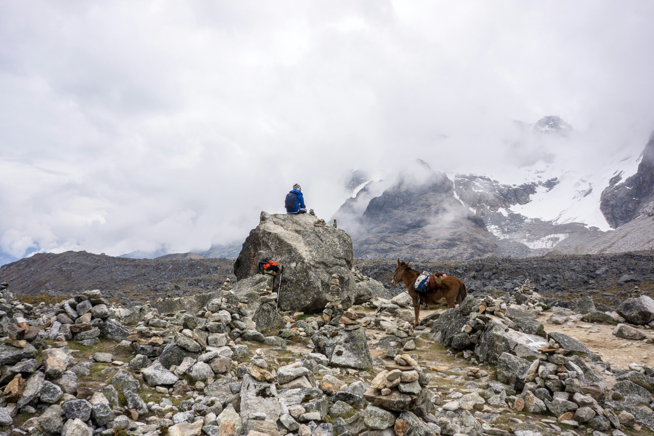
What it is: a 5-day trek over the Salkantay pass (4,600m) to Machu Picchu, passing through several distinct ecosystems from high Andean plateau to cloud forest. More physically demanding than the Inca Trail, more visually varied, and not restricted by the permit quotas that make the Inca Trail difficult to book.
Vs the Inca Trail: the Inca Trail has the archaeological sites along the route. Salkantay has more dramatic mountain scenery and easier last-minute booking. Both end at Machu Picchu. The choice largely comes down to which matters more.
Altitude acclimatisation: essential. Cusco sits at 3,400m. Spend at least two days there before starting any high-altitude trek. Symptoms of altitude sickness (headache, nausea, fatigue) are common on arrival. Coca tea is widely drunk locally. Diamox is available from pharmacies with a prescription.
Rainy season (November to March): the trails are muddier and some sections more difficult. Not impossible but harder. Dry season (April to October) is the standard trekking window.
🌅 Pai Canyon, Thailand: The Sunset Hike
Pai generates a specific type of question in the chats: where to hike, when to go, and whether the canyon walk is manageable. It’s a short destination that benefits from knowing exactly what to do.
The Pai Canyon questions come up consistently: “Anyone got good recommendations for a nice lazy day with no bike, food spots or nice hike accessible by walking around Pai?”
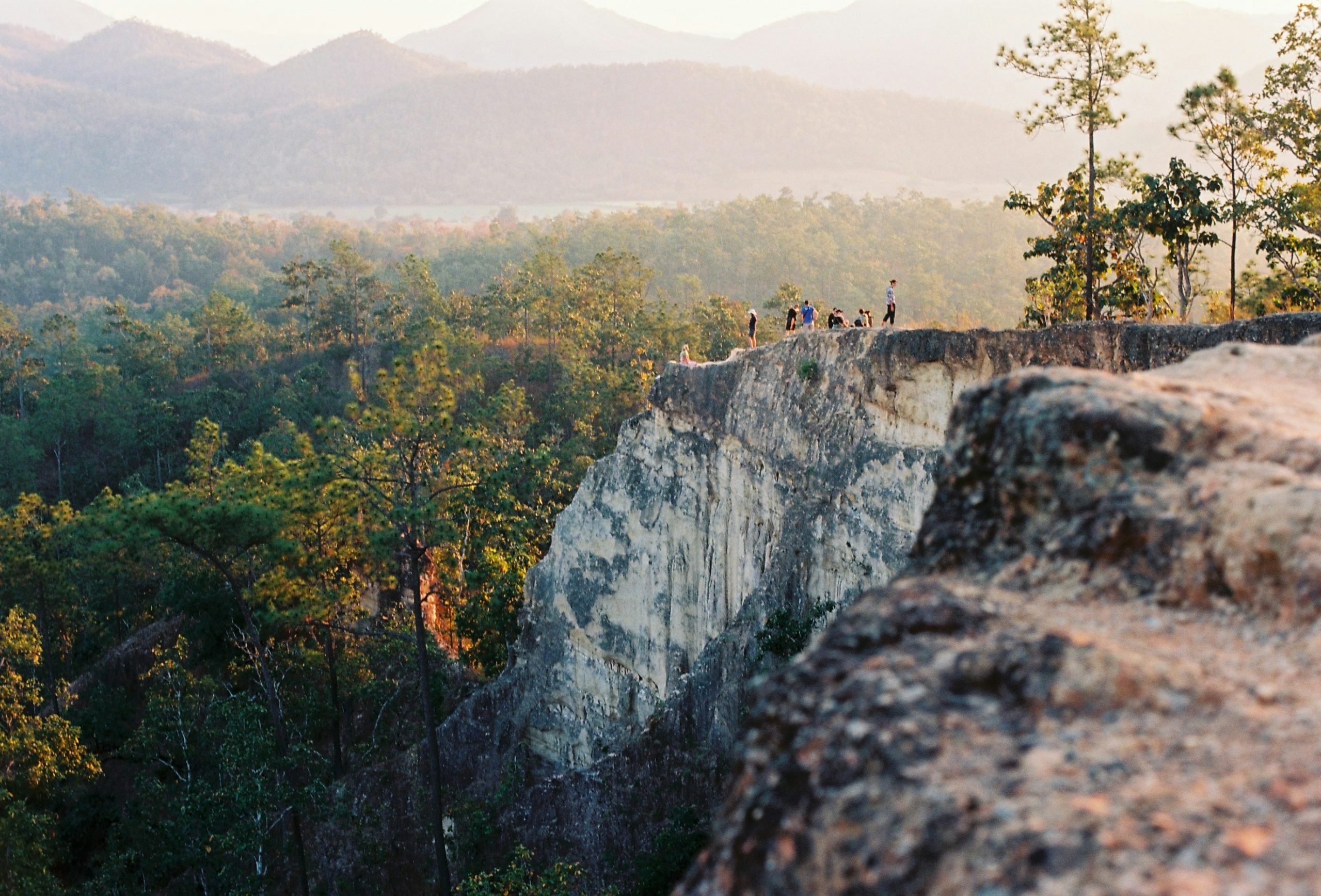
What it is: a narrow ridge walk above dramatic sandstone formations with views over the valley and forested hills. The canyon sits about 8km from Pai town and is a 30-40 minute scooter ride or cheap songthaew (shared truck) ride. The trail takes 1-2 hours.
The timing question: sunset is the answer. The canyon faces west and the light in the last hour before sunset is exceptional. Arrive 60-90 minutes before sunset to walk the ridge in good light and be positioned for the view. After dark, the path is unlit and the drops are real.
The drops are real: parts of the canyon walk are narrow paths with significant drops on both sides. It’s not technically difficult but it requires some confidence with exposure. Sandals are fine; flip-flops are not.
While you’re in Pai: the Sticky Waterfall (Nam Tok Bua Tong) is one of the most unusual natural features in northern Thailand, a series of calcium-carbonate cascades you can walk up the face of rather than around. Around 60km from Pai toward Chiang Mai on Route 1095. Worth building into a transit day.
🌿 Monk’s Trail and Doi Inthanon, Chiang Mai
Chiang Mai generates more hiking chat than almost any city in Southeast Asia, with two distinct trails consistently asked about.
From the Chiang Mai City Chat: “hi, does anyone know any hike track around Chiang Mai?” And: “Hey does anyone know how long the Monk’s Trail hike takes to do?” And: “Anyone wanna do sunrise Monk’s Trail together tomorrow?” And: “Is there a specific address I can put for the north gate, or is it easy to find from the trailhead?”
Monk’s Trail: a 4km trail that begins at Wat Palad, a forest temple on the foothills of Doi Suthep, and climbs to Doi Suthep temple at the top. Takes 1.5-2 hours. Usually hiked in the morning for sunrise. Begins from a small entrance near the Chiang Mai Zoo. Free, well-marked, genuinely beautiful. The standard recommendation for a first full day in Chiang Mai.
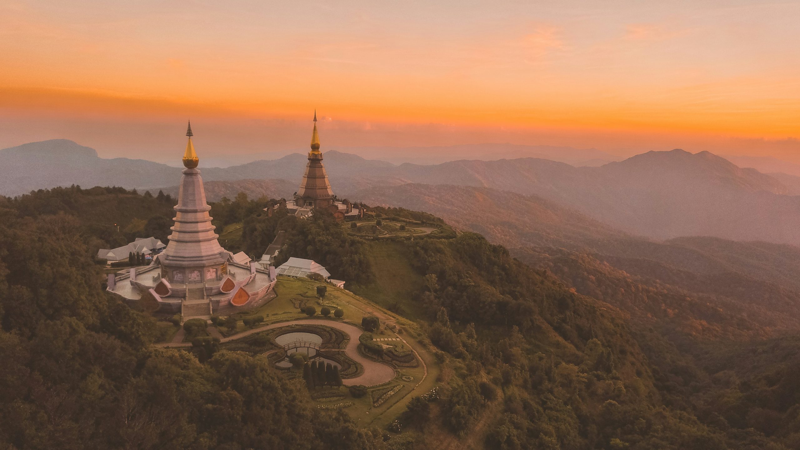
Doi Inthanon: Thailand’s highest peak (2,565m), around 80km southwest of Chiang Mai. A full-day trip by scooter or tour, passing twin pagodas, cloud forest, and the summit viewpoint. Significantly colder at the top than in the city (bring a layer). Best visited by 9am before clouds obscure the views.
The Chiang Mai hike-share culture is strong. Post in the HostelworldCity Chat the evening before and you’ll regularly find a group forming for the Monk’s Trail. “Still meeting at 2:45 with some folks, if anyone else wants to join for an earlier hike.”

🗺️ How to Find Hiking Companions on the Road
Every single hike in this guide is better with company, both for safety and for the experience of sharing it. The good news is that the Hostelworld chat infrastructure makes finding companions genuinely easy.
Before you arrive: post in the Hostelworld Hostel Chat (joinable 48 hours before check-in) with your hiking plan. “Anyone doing the Ha Giang loop around the 28th?” reaches everyone else at your hostel before you’ve even landed.
When you’re there: the City Chat connects you with travellers across all hostels in the city. Hiking posts get responses fast in popular destinations. “Is anyone doing any hike tomorrow? I’d love to join someone or a group.” (Chiang Mai City Chat) is a message that works every time.
The Social Pass gives you access to city chats and meetups even without a hostel booking, useful if you’re camping or staying somewhere that isn’t on Hostelworld.
💸 Budget Guide: What These Hikes Actually Cost
| Hike | Duration | Approx. cost | Guide needed? |
|---|---|---|---|
| Ha Giang Loop | 3-5 days | €80-150 guided | Optional (recommended for beginners) |
| Acatenango Volcano | Overnight | €40-60 | Yes |
| Cocora Valley | Half day | €5-10 | No |
| W Trek | 4-5 days | €600-900 | No (but book refugios) |
| Salkantay Trek | 5 days | €250-400 | Yes |
| Pai Canyon | 2-3 hours | Free | No |
| Monk’s Trail (Chiang Mai) | 1.5-2 hours | Free | No |
| Doi Inthanon | Full day | €20-40 (tour) or petrol cost | No |
✅ Final Thoughts: The Hikes Are Waiting, The Chats Will Get You There
Every hike in this guide has been done by thousands of backpackers before you. The routes are established. The operators are vetted by word of mouth through years of traveller recommendations. The questions in the Hostelworld chats are the same questions you’re probably asking right now, and they get answered fast by people who stood in the same spot two days ago.
Use the Hostel Chat and City Chat. They’re the fastest way to find companions for the trail, get current conditions from someone who just came back, and organise transport sharing, costs splitting, and the logistics that make self-organised hiking much easier than it looks from a hostel common room.
The hike is almost always better than the photo. Start planning.
Download the Hostelworld app to start booking now


❓ FAQs: Most Asked-About Hikes
Is the Acatenango hike worth it?
Yes, consistently. Camping at altitude with views of Volcán de Fuego erupting across the valley is one of the most dramatic experiences in Central America. It's physically demanding and cold at night. Acclimatise in Antigua first and do it with an organised tour rather than independently.
How do I book the W Trek in Patagonia?
Book refugios and campsites through the CONAF portal or directly with the operators (Vertice Patagonia, Las Torres) months in advance for peak season (November to March). Puerto Natales gear shops can help with equipment rental. Don't arrive without a booking.
Is the Cocora Valley hike easy?
The Cocora Valley loop is moderate. Some sections are muddy, particularly in wet season. Four to six hours for the full circuit. Jeeps leave from Salento's main square from around 6am. Go early for the best light and fewer crowds.
What's the difference between the Salkantay and Inca Trail?
The Inca Trail has more archaeological sites along the route. The Salkantay has more dramatic mountain scenery and is easier to book without months of advance planning. Both end at Machu Picchu. The Salkantay crosses a higher pass (4,600m) and takes 5 days.
Can I hike Pai Canyon alone?
Yes. The trail is well-marked and free to access. Arrive around 60-90 minutes before sunset for the best light. Some sections have significant drops: wear proper shoes, not flip-flops. The trail takes 1-2 hours.
How do I find hiking companions through Hostelworld?
Post in the Hostelworld Hostel Chat (available 48 hours before check-in) or the City Chat for your destination. Hiking posts get fast responses in popular trail destinations.


 Get the App.